
Executive Overview
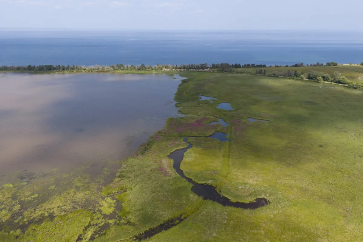
Nestled at the western tip of Lake Superior lies Allouez Bay, a vital ecological jewel and one of the largest intact wetland complexes remaining within the St. Louis River Estuary. Recently, this critical ecosystem served as the backdrop for a high-profile gathering hosted by Audubon Great Lakes and the Wisconsin Department of Natural Resources (WDNR). Conservationists, tribal leaders, municipal officials, and federal partners boarded boats to inspect firsthand the fruits of a multi-year, multi-partner collaborative endeavor. Their mission: to witness the ongoing resurrection of a landscape battered by industrial legacies and choked by invasive species, but now fighting its way back to ecological health through modern science and persistent stewardship.
The stakes at Allouez Bay could not be higher. Designated as an Important Bird Area (IBA), the bay holds the distinction of being the last known breeding site for Black Terns within the entire St. Louis River Estuary. It also provides critical nesting, feeding, and staging grounds for an array of secretive marsh birds, waterfowl, native fish, and aquatic flora, including Manoomin (wild rice), a culturally irreplaceable species for local indigenous communities.
For years, this delicate balance has been threatened by the relentless spread of invasive narrowleaf and hybrid cattails. These aggressive interlopers form dense, impenetrable monocultures that choke out native biodiversity and eliminate the crucial interspersion of open water and vegetation required by wetland-dependent wildlife. However, fueled by foundational support from the federal Great Lakes Restoration Initiative (GLRI) and guided by an alliance of more than 25 distinct organizations, a comprehensive healing process is underway.
This article examines the exhaustive efforts to restore Allouez Bay, detailing the chronological progression of field operations, the rigorous scientific frameworks monitoring the ecosystem’s response, the insights shared by key stakeholders, and the forward-looking strategies designed to ensure that this coastal wetland remains a resilient sanctuary for generations to come.
Detailed Chronology of the Restoration Effort
The revitalization of Allouez Bay is not an overnight fix, but rather a meticulously planned, multi-phase ecological engineering campaign that relies heavily on adaptive management—a framework where on-the-ground actions are continually adjusted based on real-time scientific feedback.
The Genesis of Action: Laying the Groundwork (Pre-2024)
Before a single machine touched the soil of Allouez Bay, years were spent laying the institutional, scientific, and community groundwork. Recognizing the accelerating degradation caused by invasive narrowleaf cattails (Typha angustifolia) and hybrid cattails (Typha glauca), Audubon Great Lakes and the WDNR, alongside over two dozen partners, coalesced around a unified vision.
Crucially, project planners understood that baseline data was essential. Beginning years prior to active restoration, researchers from the Natural Resources Research Institute (NRRI) launched rigorous avian surveys to document baseline bird populations, while ecological consultants began mapping vegetation trends. This preparatory phase ensured that when federal funds from the Great Lakes Restoration Initiative were secured, every dollar and operational hour could be deployed with surgical precision.
Phase One: Mechanical Intervention and Habitat Sculpting (2024)
The physical transformation of Allouez Bay shifted into high gear in 2024. Crews executed targeted mechanical operations to disrupt the dense monocultures of invasive cattails that had locked up large swaths of the marsh.
- Initial Knockdown: Crews utilized specialized mechanical mowers and hand-cutting techniques to clear approximately seven acres of dense, invasive cattail stands. This initial haircut reduced the accumulated biomass and weakened the plants’ root systems.
- Hemi-Marsh Creation: Later that same year, approximately 12 acres of high-value "hemi-marsh" habitat were carved directly into the dense cattail mats. By excavating a complex network of channels and shallow pools, project engineers restored the vital structural diversity of the wetland—reintroducing the roughly 50-50 ratio of open water to emergent vegetation that defines a healthy hemi-marsh.
- Targeted Seeding: Following the excavation, crews immediately seeded the freshly exposed soils with a diverse mix of native wetland plant species designed to outcompete regenerating invasive strains.
Phase Two: Adaptive Re-Treatment and Early Signs of Life (2025)
Ecosystem restoration is rarely a "one-and-done" endeavor. In 2025, restoration crews returned to the site to execute a critical wave of adaptive re-treatment, tackling approximately six acres of stubborn, regenerating invasive cattails. This responsiveness is the hallmark of adaptive management: identifying where invasive species are attempting to stage a comeback and striking before they can re-establish dominance.
By the summer of 2025, the early ecological returns were profoundly encouraging. In the newly excavated channels and pools, Manoomin (wild rice) and other foundational native wetland plants began to naturally establish themselves. Simultaneously, the seeded native vegetation demonstrated a strong capacity to hold its ground against the suppressed, yet persistent, invasive cattails.
The Horizon: Advanced Control and Drone Surveillance (2026 and Beyond)
As the project enters its next milestones in 2026, the partnership is refusing to rest on its laurels. Building upon lessons learned from previous seasons, the restoration team is preparing to pilot an innovative, aggressive method of invasive cattail control across an additional five-acre test plot.
Rather than standard mowing or spraying, upcoming operations will involve heavy equipment designed to grind cattail vegetation and root material significantly closer to the soil surface. The objective is to determine whether this intensive root-zone disruption can more effectively exhaust the carbohydrate reserves of dense cattail stands and drastically slow their regrowth.
To protect ecological integrity, high-precision, selective control methods will continue to be deployed in close proximity to sensitive Manoomin beds and other high-quality native plant communities. Furthermore, project managers are incorporating cutting-edge technology—utilizing high-resolution drone imagery—to map vegetative shifts, track project footprints, and document macro-scale changes across the entire Allouez Bay wetland complex with unprecedented accuracy.
Supporting Context & Ecological Metrics
To truly grasp the significance of the Allouez Bay restoration, one must understand the ecological architecture of the St. Louis River Estuary and the specific vulnerabilities facing freshwater coastal wetlands in the upper Midwest.
The Ecological Significance of Allouez Bay
Coastal wetlands are among the most biologically productive ecosystems on Earth, acting as natural water filters, flood buffers, and nurseries for aquatic life. Within the St. Louis River Estuary, Allouez Bay stands out as one of the largest remaining intact wetland complexes.
The site’s unique ecological profile includes:
- Avian Hotspot: Designated as an Important Bird Area (IBA), Allouez Bay provides essential breeding, nesting, and stopover habitat for a staggering diversity of avian species. It is famously recognized as the last known breeding sanctuary for Black Terns (Chlidonias niger) within the estuary.
- Secretive Marsh Birds: The restoration directly benefits a suite of elusive, high-priority marsh birds whose populations have faced steep regional declines. Monitoring programs have repeatedly detected Virginia Rails (Rallus limicola), Least Bitterns (Ixobrychus exilis), American Bitterns (Botaurus lentiginosus), and Yellow-headed Blackbirds (Xanthocephalus xanthocephalus).
- Cultural and Natural Heritage: The bay serves as a prime growing environment for Manoomin (wild rice), an aquatic grain of immense ecological value to waterfowl and profound spiritual, cultural, and nutritional significance to the Ojibwe Tribal Nations of the region.
The Threat of Invasive Cattails
The primary antagonist in the Allouez Bay drama is the aggressive proliferation of non-native narrowleaf cattail (Typha angustifolia) and its prolific hybrid offspring (Typha x glauca). Unlike native broadleaf cattails (Typha latifolia), which tend to coexist peacefully within diverse plant communities, invasive cattails possess physiological advantages that allow them to form dense, towering monocultures.
These "cattail deserts" alter the physical and biological properties of the wetland in several damaging ways:
- Loss of Open Water: By eliminating pools and channels, they destroy the hemi-marsh conditions required by diving ducks, grebes, and marsh-nesting rails.
- Nutrient Lock-up: Dense cattail stands absorb massive quantities of nutrients and trap sediment, altering the geochemical cycling of the marsh.
- Physical Impenetrability: The accumulated mass of dead leaves and stems (litter) forms deep, toxic mats that physically block native seeds from germinating, effectively locking the ecosystem in a degraded, low-diversity state.
Metrics of Success: The Science of Monitoring
Good conservation is driven by hard data. The Allouez Bay project utilizes a two-pronged scientific monitoring framework to quantify change:
- Vegetation Tracking (Tsuga Consulting): Botanists systematically survey permanent transects and plots to measure changes in plant species richness, canopy cover, and the spatial distribution of invasive cattails versus native assemblages.
- Avian Response Monitoring (Natural Resources Research Institute – NRRI): Ornithologists have maintained a multi-year dataset, recording bird presence, breeding activity, and habitat utilization before, during, and after restoration activities. By comparing pre-restoration bird densities with post-restoration counts, researchers can scientifically link habitat structural changes (such as the opening of water channels) directly to the demographic recovery of target bird species.
Official Statements and Stakeholder Perspectives
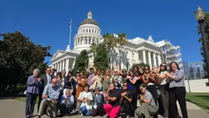
The recent boat tour and luncheon brought together an extraordinary cross-section of leadership, highlighting that wetland restoration is as much about human community building as it is about environmental engineering.
The collaborative spirit was powerfully demonstrated by the diverse roster of participants, which included Wisconsin Department of Natural Resources (WDNR) Secretary Karen Hyun and senior agency officials; Superior Mayor Jim Paine; tribal representatives from the Fond du Lac Band of Lake Superior Chippewa and the St. Croix Band of Lake Superior Chippewa; experts from the Great Lakes Indian Fish and Wildlife Commission (GLIFWC), the Lake Superior National Estuarine Research Reserve, the Natural Resources Research Institute (NRRI), the St. Louis River Alliance, Tsuga Consulting; and federal engineers from the U.S. Army Corps of Engineers.
Speaking on the collaborative nature of the initiative, local and state leaders emphasized that the successes witnessed at Allouez Bay serve as a blueprint for watershed recovery across the Great Lakes basin.
Mayor Jim Paine of Superior underscored the city’s intrinsic connection to the bay, noting that a healthy waterfront is foundational to the quality of life, recreational opportunities, and economic vitality of the community. Tribal representatives highlighted the vital importance of protecting and reviving Manoomin beds, emphasizing that ecological restoration must honor treaty rights and cultural traditions by ensuring that native plants and animals can once again flourish.
State and federal officials pointed to the Great Lakes Restoration Initiative (GLRI) as the indispensable financial engine that makes such large-scale, complex engineering and biological projects possible. By pooling resources, sharing technical expertise, and breaking down agency silos, the partnership has achieved in a few short years what would have taken decades for any single entity to accomplish alone.
Future Outlook
As the partners look beyond 2026, the overarching strategy for Allouez Bay remains clear, adaptive, and unwavering: listen to the wetland, adapt management practices based on empirical data, protect the high-quality habitats that remain intact, and aggressively heal the areas that have been degraded.
The blueprint forged in Allouez Bay is already generating ripples far beyond the borders of Superior, Wisconsin. The methods being refined here—ranging from mechanical hemi-marsh excavation to innovative root-zone grinding of invasive cattails, paired with rigorous before-and-after avian and botanical monitoring—provide a valuable template for coastal wetland restoration projects across the entire Great Lakes basin.
Ultimately, the recent gathering on the waters of Allouez Bay was more than just a site tour; it was a celebration of collective resolve. With sustained federal backing from the Great Lakes Restoration Initiative, active tribal leadership, rigorous scientific oversight, and the steadfast commitment of conservation groups like Audubon Great Lakes and the WDNR, Allouez Bay is well on its way to remaining a vibrant, resilient sanctuary. For the Black Terns wheeling overhead, the secretive rails calling from the reeds, the lush beds of wild rice, and the human communities that call the St. Louis River Estuary home, the future of Allouez Bay is undeniably looking brighter.