
Executive Overview
For decades, conventional conservation wisdom treated sprawling metropolitan areas as biological dead zones—asphalt deserts devoid of ecological value where wildlife was either displaced or doomed. However, a startling new study published in the journal Nature has upended this long-standing narrative. Millions of migrating birds are bypassing traditional wilderness corridors to rest, feed, and refuel directly within the heart of urban America on a massive, unprecedented scale.
Led by researcher Miguel Jimenez during his Ph.D. work at Colorado State University, the nationwide analysis utilized advanced weather radar data to map migratory stopover patterns across the continental United States. The findings are nothing short of revolutionary: nearly half of all major bird migration "hotspots"—regions where exceptionally high concentrations of birds touch down to recover during grueling seasonal journeys—are located inside metropolitan boundaries. Specifically, urban areas account for 48 percent of these critical stopovers in the spring and 44 percent in the fall.
Given that metropolitan areas occupy a relatively small fraction of the total North American landmass, these figures indicate that birds are using cities at rates vastly disproportionate to their size. With roughly 86 percent of the U.S. population residing in these same urban centers, this discovery fundamentally transforms the scope of wildlife conservation. It shifts the burden—and the opportunity—of protecting billions of migratory birds from remote national parks and rural preserves directly onto city dwellers, urban planners, and municipal governments.
Detailed Chronology: How the Discovery Unfolded
The Accidental Discovery
When Miguel Jimenez first processed the preliminary data outputs from his continental mapping model, he assumed a software glitch had corrupted the numbers. The visualizations showed massive, dense clusters of migratory activity illuminating metropolitan regions like Chicago, Los Angeles, Dallas, and Atlanta.
Historically, mainstream ornithology focused almost exclusively on pristine habitats—forests, wetlands, and coastal preserves—when tracking avian migration. Urban centers were viewed primarily as ecological hazards defined by window strikes, light pollution, and feral cats.
"There’s this narrative that on the conservation front, there’s not much action that we can take in cities," Jimenez explains. Reluctant to accept conventional dogmas without empirical backing, he set out to answer a singular, provocative question: How much migratory stopover actually happens in cities?
Scaling Up with Weather Radar
To answer this, Jimenez and his research team had to pivot away from traditional, localized observation methods. Past studies of urban bird behaviors were largely restricted to single cities or isolated regions, making it impossible to evaluate cities as macro-level players in global ecological phenomena.
To overcome this limitation, the research team turned to an unexpected technological ally: the National Weather Service’s network of Doppler weather radars (NEXRAD). Originally designed to detect raindrops, snowflakes, and severe storm fronts, these powerful radar sweeps are equally adept at capturing massive atmospheric phenomena—including towering, dense clouds of nocturnal migrating birds taking flight or descending at dawn.
By analyzing years of historical radar scans, the team bypassed the human biases inherent in community science apps like eBird and iNaturalist. While citizen science platforms are invaluable, they suffer from socio-economic skewing: people in affluent neighborhoods log significantly more wildlife observations than those in lower-income or industrial districts. Radar, by contrast, offered an impartial, macro-scale lens, sweeping equally across urban cores, industrial parks, and wealthy suburbs alike.
Publication and Public Awakening
Published earlier this year in Nature, the study immediately caught the attention of both the scientific community and major conservation organizations like the National Audubon Society. By proving that nearly half of all migratory stopover hotspots sit squarely inside metropolitan borders, the study forced a rapid reassessment of urban ecology. Cities were no longer seen merely as obstacles to be navigated, but as essential, high-stakes stepping stones in the complex geography of avian migration.
Supporting Context & Metrics: The Science of Urban Avian Hotspots
The Magnets of the Metropolis: Light and Water
Why are millions of birds choosing concrete jungles over rural fields? According to Jimenez and subsequent analyses by urban ecologists, two primary environmental factors act as powerful attractants: artificial illumination and water resources.
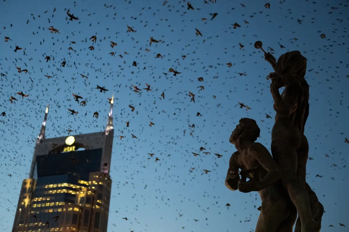
- Light Pollution: Cities are incandescent beacons visible from space. Nocturnal migrants—which navigate using the stars, the Earth’s magnetic field, and polarized sunset light—are routinely disoriented by blinding artificial light arrays. Drawn toward the glow, millions of birds are funneled directly into metropolitan cores, where they are forced to drop out of the sky and seek shelter at dawn.
- Hydrological Infrastructure: Urban centers are historically and strategically engineered around water. Cities almost universally sit along major rivers, coastlines, or natural drainage basins. Furthermore, urban irrigation, decorative lakes, park ponds, and stormwater management systems create concentrated oases of water within otherwise dry or altered landscapes.
This hypothesis is powerfully reinforced by one of the study’s most striking geographic discoveries: urban migration hotspots are statistically more prevalent in the western United States than in the East.
In arid western regions like Southern California and the desert Southwest, the surrounding natural landscape is often a harsh, food-poor desert. By comparison, well-watered urban parks, suburban lawns, and landscaped corporate campuses provide crucial hydration and insect populations that desperate migrants cannot find in the wild backcountry.
The "Luxury Effect" and Socio-Economic Disparities
In examining arid western cities like Los Angeles, Phoenix, and San Diego, the researchers uncovered a fascinating socio-economic nuance known in urban ecology as the "luxury effect."
The luxury effect predicts that urban biodiversity—particularly plant richness, tree canopy coverage, and bird abundance—tends to increase sharply in wealthier neighborhoods. Because affluent residents can afford more extensive landscaping, private pools, mature trees, and lush green spaces, these neighborhoods inadvertently function as high-quality ecological refuges.
"People and birds alike prefer wetter, greener spaces," notes Melanie Smith, science and conservation product director at the National Audubon Society, who led the development of Audubon’s interactive Bird Migration Explorer. "Urban green spaces in these western cities aren’t just recreational amenities for people. They’re functioning as critical habitat."
This disparity highlights an urgent environmental justice issue within urban conservation. Lower-income urban neighborhoods, historically subjected to redlining, industrial zoning, and "heat island" effects, often lack the green infrastructure required to support tired, starving birds. Ensuring equitable access to nature in cities is therefore not just a human welfare issue, but a critical wildlife conservation strategy.
Official Statements and Expert Perspectives
The paradigm shift catalyzed by Jimenez’s research has drawn widespread praise and critical commentary from leading voices in ornithology and urban planning.
-
Miguel Jimenez (Lead Researcher & Former Outreach Biologist, Audubon Migratory Bird Initiative):
Reflecting on the unexpected magnitude of the radar data, Jimenez emphasizes the broader implications for national growth:"The initial hotspot numbers were pretty shocking, but the more I thought about it, it made a lot of sense. Ultimately, the study speaks to how quickly the country is still urbanizing. Studies like his show how we can make urban development better and safer for birds—and since so many birds rest in cities, it’s critical that we do so."
-
Melanie Smith (Science and Conservation Product Director, National Audubon Society):
Commenting on the synthesis of radar data and community science, Smith highlights the unique synergy of modern conservation tools:"Through sources like eBird, you get a sense of the species mix and relative abundance of those species. By pairing that with radar’s estimate of abundance, you get a powerful tool for monitoring urban areas. We are moving past the old assumption that cities are dead zones for nature."
Future Outlook: Transforming Cities into Safe Harbors
The revelation that urban areas serve as vital migratory stopovers carries an immense sense of urgency. The United States continues to urbanize at a breakneck pace, and the threats facing migrating birds within metropolitan borders are severe and escalating.
Each year, over one billion birds are killed in the United States alone due to collisions with glass windows, a mortality rate that peaks sharply during spring and fall migrations. When combined with unmitigated light pollution—which drags birds off course and exhausts them—and the ubiquity of roaming outdoor cats, urban environments can easily become ecological traps.
However, the very fact that birds are utilizing cities in such high numbers presents a historic conservation opportunity. Because 86 percent of Americans live in metropolitan areas, the collective power of urban residents can directly alter the survival odds for billions of migrating animals.
Actionable Pathways for Urban Conservation
Transforming concrete jungles into safe migration corridors requires a multi-pronged approach involving individual actions, municipal policy shifts, and architectural innovations:
- Light Mitigation Campaigns: Building owners, property managers, and city residents can participate in nationwide initiatives like Audubon’s "Lights Out" programs. By simply extinguishing non-essential architectural and interior lighting during peak migration hours (midnight to dawn), cities can dramatically reduce avian disorientation and deadly building collisions.
- Bird-Safe Architecture: Architects and urban planners must embrace bird-friendly building codes. Mandating the use of patterned, UV-reflective, or fritted glass prevents windows from reflecting open sky and foliage, stopping window strikes before they occur. Federal measures like the proposed Bird-Safe Building Act represent vital legislative steps forward.
- Enhancing Urban Green Space & Rewilding: City governments and local communities must invest in urban rewilding, creating microforests, and planting native flora. Native plants support native insect populations, providing the high-protein diet that exhausted migrants desperately need to complete their journeys.
- Keeping Pets Indoors: Pet owners can protect local wildlife by keeping domestic cats indoors or outrunning them in enclosed catios, drastically reducing the billions of bird fatalities attributed to free-roaming felines annually.
- Bridging the Luxury Gap: Municipalities must intentionally distribute green infrastructure equitably, ensuring that under-resourced neighborhoods receive investments in street trees, parks, and community gardens that benefit both human communities and migratory wildlife.
For the billions of warblers, thrushes, sparrows, and shorelines navigating the perilous skies above North America every spring and fall, the actions taken in our cities will dictate their survival. With urban conservation now standing at the very forefront of ornithological science, any step taken—from turning off a porch light to passing municipal bird-safe legislation—can mean the difference between a successful journey and a tragic ending.