
Executive Overview
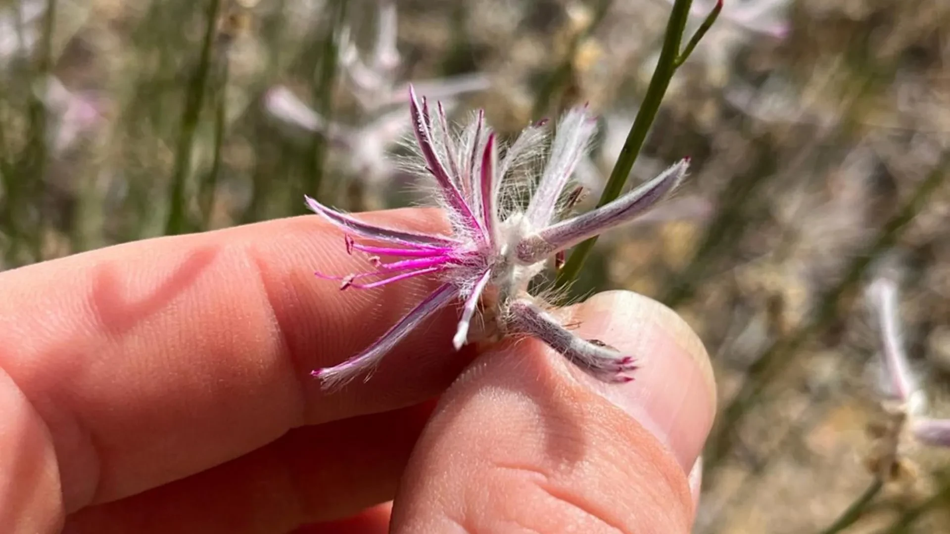
In the vast, sun-scorched expanse of northern Australia’s remote outback, a botanical ghost has been brought back to life. Ptilotus senarius—a delicate, striking shrub characterized by its purple-pink blooms that resemble bursts of feathered fireworks—had not been officially documented in the wild since 1967. For nearly six decades, the scientific community operated under the grim assumption that the species had succumbed to environmental pressures, joining the tragic catalogue of roughly 900 plant species lost to the globe since the 1750s.
Yet, in an era defined by rapid technological connectivity and grassroots ecological participation, extinction is no longer always a one-way street. The Lazarus-like rediscovery of Ptilotus senarius did not happen during a heavily funded, multi-year institutional expedition. Instead, it was catalyzed by a chance observation, a smartphone camera, and the digital infrastructure of iNaturalist, a global citizen science platform.
This remarkable event underscores a profound paradigm shift in modern biodiversity research. As professional scientists face severe constraints in funding, manpower, and geographic access, everyday citizens, horticulturalists, and private landowners are stepping into the breach. Armed with digital cameras and cellular networks, they are transforming from passive observers into frontline guardians of planetary biodiversity. This comprehensive report examines the serendipitous chain of events behind the rediscovery, the mechanics of modern citizen science, the unique challenges of surveying Australia’s rugged and private landscapes, and what this milestone means for the future of global conservation.
Detailed Chronology: Anatomy of a Botanical Resurrection
The story of the Ptilotus senarius rediscovery reads like a masterclass in modern serendipity, bridging the gap between field observation and specialized taxonomic expertise across thousands of kilometers.
Phase 1: The Outpost Encounter
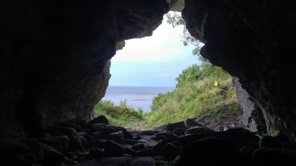
The journey back from the brink of extinction began on a sprawling outback property near the Gulf of Carpentaria in Queensland. Aaron Bean, a professional horticulturalist by trade, was working in the field, assisting researchers with banding birds across the expansive property. Amid the rugged, unforgiving terrain typical of northern Australia, Bean’s trained eye caught sight of an unfamiliar shrub.
Unlike the resilient yet monotonous flora dominating the immediate landscape, this plant featured distinct, alluring purple-pink flowers shaped remarkably like microscopic feathered fireworks. Recognizing that the plant looked unusual and potentially significant, Bean paused his ornithological duties to document it. Utilizing his smartphone, he captured multiple photographs of the flora, logging its visual characteristics against the backdrop of its native soil. However, due to the extreme remoteness of the location, cellular service was nonexistent. The digital files remained dormant in his phone’s local memory while he continued his fieldwork.
Phase 2: The Digital Upload
Days later, upon returning to an area with reliable phone service, Aaron Bean uploaded his digital field notes and photographs to iNaturalist—a crowdsourced biodiversity mapping platform where users worldwide share geo-referenced images of flora and fauna for community identification and scientific archiving.
By pushing those images into the public digital ether, Bean unknowingly cast a line into a vast ocean of global biological data. Every day, millions of observations are uploaded to platforms like iNaturalist, creating a chaotic, decentralized repository of life on Earth. Most uploads are mundane backyard sightings of common weeds or local birds. But occasionally, a needle rests quietly within the cosmic haystack.
Phase 3: The Taxonomic Lightning Strike
Among the thousands of professionals and amateur naturalists browsing the platform, the upload eventually crossed paths with a digital notification that would stop a veteran botanist in his tracks. Anthony Bean—a seasoned researcher with the Queensland Herbarium—was reviewing observations when the images from the Gulf of Carpentaria caught his attention.
To an untrained eye, the shrub might have blended into the background of regional vegetation. To Anthony Bean, however, the morphology was instantly, stunningly familiar. He recognized the distinct floral structure of Ptilotus senarius. Even more remarkably, Anthony Bean was not just an expert casually browsing; he was the very scientist who had formally described and named the species a decade prior to its disappearance, based on historical herbarium vouchers.
The plant he thought he might never see alive again in his lifetime was sitting on his computer screen, photographed mere days prior.
Phase 4: Verification and Reclassification
Recognizing the monumental implications of the find, Anthony Bean reached out to coordinate validation. The digital trail quickly transitioned into physical science. Researchers enlisted the cooperation of the local property owner, who granted access to secure an authentic botanical specimen.
With the physical voucher secured, researchers compared the fresh sample against historical records. The scientific consensus was swift and undeniable: Ptilotus senarius was alive.
The ramifications of the confirmation were immediate. Botanically speaking, the species was officially hauled back from the abyss. Instead of lingering in the desolate category of "extinct in the wild," the International Union for Conservation of Nature (IUCN) framework metrics allowed researchers to reclassify Ptilotus senarius as "critically endangered." This elevation in status is far more than a bureaucratic semantics shift; it is a vital regulatory and ecological upgrade that unlocks research funding, mandates habitat monitoring, and mobilizes conservation groups to draft targeted protection plans before it is too late.
Supporting Context & Metrics: The Scale of the Crisis and the Digital Solution
To fully appreciate the weight of this discovery, one must examine the broader metrics governing modern extinction rates and the structural limitations facing contemporary biological surveys.
The Global Extinction Ledger
According to historical botanical surveys and institutional tallies, roughly 900 plant species have vanished from the face of the Earth since the 1750s. Plant extinctions often occur silently, unheralded by the dramatic media coverage frequently afforded to charismatic megafauna like rhinos or tigers. Yet, plants form the foundational trophic layers of every terrestrial ecosystem on Earth. When a single plant species blinks out of existence, it often takes down an entire micro-web of dependent insects, fungi, and herbivores.
Australia, in particular, is a global biodiversity hotspot, hosting hundreds of thousands of endemic species found nowhere else on the planet. However, its ecosystems are under escalating threat from habitat fragmentation, invasive species, climate change, and altered fire regimes.
The Tyranny of Distance and Land Ownership
Conducting comprehensive biological surveys across the Australian continent presents a logistical nightmare for institutional science. Australia is roughly the size of the contiguous United States, yet it supports a fraction of the population density. Vast tracts of land are entirely inaccessible by standard vehicular transport, requiring expensive helicopter charters, long-term expeditions, and grueling field conditions.
Compounding this geographic tyranny is the issue of land tenure. Approximately one-third of the entire Australian continent consists of privately owned land, spanning massive pastoral leases, private farms, and indigenous holdings. Professional scientists cannot simply wander onto private property to conduct botanical sweeps without explicit, often difficult-to-secure permissions.
This is where platforms like iNaturalist dismantle traditional institutional barriers.
- "If you are the property owner or you’re someone who has permission from the owner to be there, then suddenly it opens up this whole new world," notes Thomas Mesaglio, a researcher from the UNSW School of Biological, Earth and Environmental Sciences who documented the rediscovery for the Australian Journal of Botany.
- Private landholders, farm managers, indigenous rangers, and rural workers become decentralized biological surveyors. They inhabit the exact landscapes that scientists rarely visit, traversing private pastures and remote bushland on a daily basis.
The Quantitative Rise of iNaturalist in Global Science
The utility of platforms like iNaturalist is no longer viewed as a novel curiosity by the academic community; it has evolved into hard, empirical science.
In independent research spearheaded by Thomas Mesaglio, data revealed that iNaturalist observations have already been formally cited in peer-reviewed scientific papers across 128 countries, encompassing thousands of distinct species. The platform acts as a real-time, global early-warning system for biodiversity shifts, range expansions, invasive species incursions, and—as demonstrated by Ptilotus senarius—the Lazarus rediscovery of species written off as lost to history.
Official Statements and Expert Perspectives
The intersection of amateur enthusiasm and professional taxonomy has generated considerable optimism among the scientific community, though experts emphasize that data quality remains paramount.
The Serendipity of Success
Reflecting on the chain of events that led to the unearthing of Ptilotus senarius, Thomas Mesaglio emphasized the fragility of the discovery pathway.
"It’s one of these situations where everything had to fall into place and there was a bit of good fortune involved," Mesaglio remarked. "Aaron Bean is an avid iNaturalist user who opportunistically took some photos of a few plants that were interesting on the property. Without that habit of observation, the plant would have remained entirely invisible to science."
Bridging the Gap Through Landowner Programs
To harness this potential systematically rather than relying entirely on blind luck, conservation bodies are actively institutionalizing citizen science. A prime example is the Land Libraries project in New South Wales, operated by the state government’s Biodiversity Conservation Trust.
The Land Libraries initiative provides structured training, specialized equipment, and logistical support to private landowners. This empowers them to systematically document the flora and fauna inhabiting their properties and upload those verified datasets directly to public conservation databases.
Mesaglio advocates aggressively for the expansion of such programs on a national scale. Beyond the obvious benefit of multiplying the eyes and ears on the ground, these initiatives fundamentally alter human relationships with the natural world.
"Engaging landholders themselves with science and the natural world and getting them more passionate about diversity makes them far more likely to be interested and invested in protecting that diversity," Mesaglio explained. When a farmer or pastoralist discovers that a critically endangered, globally unique plant is growing in their back paddock, stewardship replaces indifference.
Future Outlook: Best Practices and the Next Generation of Discoveries
As millions of digital observations continue to flood into repositories like iNaturalist every month, the scientific community anticipates many more hidden treasures waiting to be unmasked. However, researchers stress that the utility of citizen science data depends heavily on the quality, context, and thoroughness of the original upload.
Masterclass in Field Documentation: Tips for Citizen Scientists
For everyday naturalists, hikers, and landowners hoping to contribute meaningfully to professional research, Thomas Mesaglio offers several critical field guidelines:
- Capture Multiple Angles: A single, close-up photograph of a flower is rarely sufficient for definitive botanical identification, especially within diverse genera where closely related species share near-identical blossom structures. Users should systematically photograph leaves, bark, branching patterns, stems, and the entire habit of the plant within its environment.
- Provide Environmental Context: Photos alone miss crucial ecological variables. Observers should record data regarding soil composition, local geology, moisture levels, nearby canopy vegetation, and whether active pollinators (bees, beetles, birds) are interacting with the specimen.
- Engage the Senses: Subtle biological markers—such as distinct aromatic profiles, sap coloration when bruised, or hair texture—cannot be captured by a camera lens. Including descriptive notes in the text field of the observation provides invaluable clues for taxonomists.
- Leverage Geolocation and Timestamp Accuracy: Ensuring that device settings accurately log GPS coordinates and dates allows researchers to track phenological shifts (such as early flowering due to climate change) and map precise geographic distributions.
The Horizon of Conservation
The rediscovery of Ptilotus senarius serves as a powerful reminder that while human activity has accelerated the degradation of the biosphere, human ingenuity and connectivity also offer unprecedented tools for remediation.
As landholder engagement programs expand, as mobile technology penetrates deeper into remote wilderness corridors, and as communication channels between amateur observers and institutional taxonomists become faster and more integrated, the boundaries of our ecological knowledge will continue to expand. The outback still guards its secrets closely, but thanks to a smartphone snapshot and a vigilant horticulturalist, one of its greatest lost treasures has stepped back into the light.