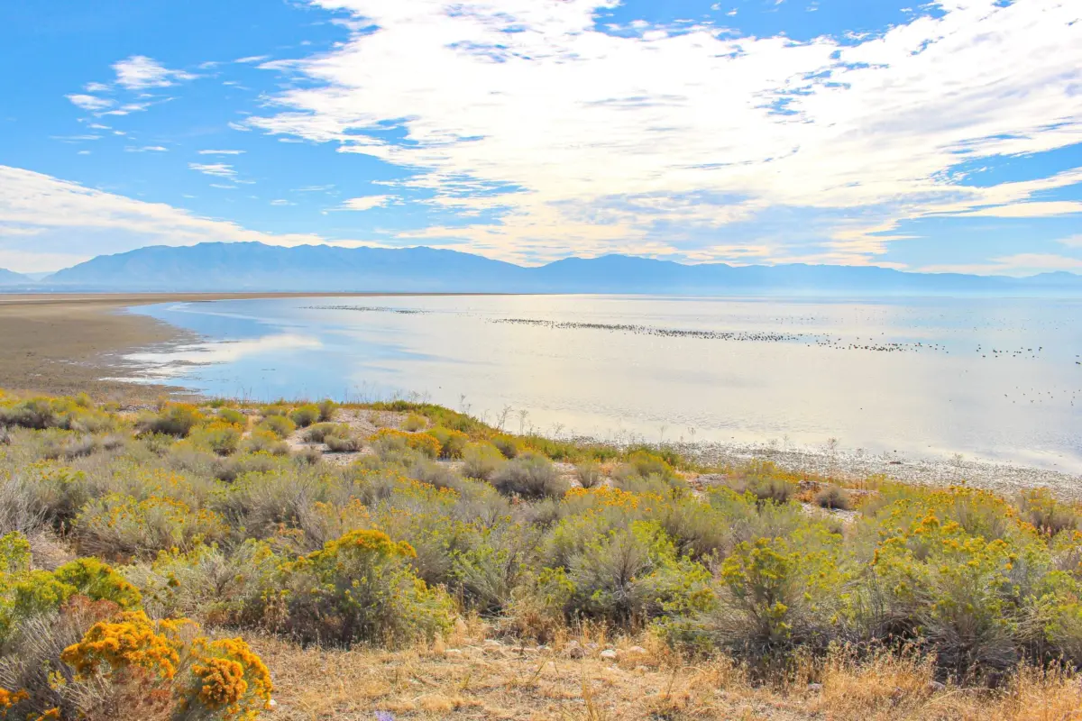

Executive Overview
The Great Salt Lake, a cornerstone of Western ecological health and a globally significant ecosystem, is undergoing a quiet revolution in how it is managed, studied, and protected. At the heart of this paradigm shift is the Audubon Great Salt Lake Birds and Habitat Assessment, a comprehensive scientific document that has quickly transcended its origins as a conservation blueprint to become an indispensable operational manual for state agencies, academic researchers, agricultural leaders, and policymakers.
In October, The Water Report—the premier monthly publication providing in-depth analysis across North American water sectors—featured the Assessment in a prominent cover-level piece. This recognition underscores a growing consensus: safeguarding the lake is no longer merely an environmental aspiration; it is an urgent, highly technical, and coordinated socio-economic imperative for the state of Utah and the broader American West.
Released to the public at the end of June 2026, the Assessment provides an unprecedented, granular look at the habitat needs, ecological bottlenecks, and conservation priorities spanning the lake’s expansive terminal basin and surrounding wetlands. Crucially, the document’s utility extends far beyond theoretical ecology. Months before and after its formal publication, Audubon staff embarked on an intensive, collaborative outreach campaign, meeting with an expansive coalition of stakeholders. These ranged from the Great Salt Lake Commissioner and the Great Salt Lake Advisory Council to academic powerhouses like Utah State University, state regulatory bodies, and agricultural organizations such as the Utah Farm Bureau.
Today, the real-world impacts of the Assessment are already compounding. Academic researchers are utilizing its spatial data to target hydrological studies; state geologists are integrating its metrics to refine wetland health assessments; and agricultural producers are leaning into the data to harmonize farming practices with migratory bird survival. As the Great Salt Lake Basin navigates the dual pressures of climate volatility and rapid urban growth, Audubon’s framework represents a unifying roadmap—proving that sound science can successfully bridge the historically contentious divides between agricultural needs, municipal growth, and environmental conservation.
Detailed Chronology: From Fieldwork to Policy Integration
To understand the profound impact of the Audubon Assessment, one must trace the timeline of its development, release, and subsequent integration into Utah’s water governance infrastructure. The journey of this document reflects a deliberate strategy of stakeholder inclusion and rigorous scientific validation.
Phase I: Conception, Research, and Data Synthesis (2024–Early 2026)
Long before its June 2026 publication, the Assessment was conceived as a direct response to the escalating crisis at the Great Salt Lake. With water levels fluctuating near historic lows in preceding years, conservationists recognized that general calls to "save the lake" were insufficient. Decision-makers required precise, actionable spatial data: Which specific wetlands are most critical for staging shorebirds? Where are water delivery systems failing to maintain critical hydrological connections?
Audubon scientists and spatial modelers spent years compiling avian survey data, hydrological monitoring records, and vegetation indices. They mapped out the complex mosaic of saline lagoons, freshwater marshes, mudflats, and agricultural tailwaters that sustain millions of migratory birds along the Pacific Flyway.
Phase II: Pre-Release Stakeholder Engagement (Spring 2026)
Recognizing that a scientific report sits on a shelf unless embraced by those who manage the land and water, Audubon initiated a proactive briefing phase in the spring of 2026. Rather than dropping the report unannounced, Audubon leadership met behind closed doors and in open workshops with key institutional players.
Consultations included high-level briefings with the Great Salt Lake Commissioner’s office, the Great Salt Lake Advisory Council, and leadership within the Utah Department of Natural Resources (DNR). These early previews allowed stakeholders to stress-test the data against their own operational realities, ensuring the final metrics would directly address regulatory and management blind spots.
Phase III: The Official Launch and Broad Coalition Briefings (June–July 2026)
In late June 2026, the Assessment was officially released to the public and the water resource community. The timing coincided with heightened seasonal scrutiny over snowmelt runoff, irrigation demands, and summer evaporation rates.
Immediately following the launch, Audubon accelerated its engagement campaign. Outreach expanded to embrace traditionally distinct sectors:
- The Utah Department of Agriculture and Food (UDAF) and the Utah Farm Bureau, ensuring that agricultural water users saw the report not as a regulatory threat, but as an informational asset.
- The Utah Geological Survey (UGS) and the Utah Division of Forestry, Fire and State Lands (FFSL), aligning the Assessment with state-level mapping and land management protocols.
- Utah State University’s Water Research Laboratory (USU WRL), bridging academic hydrological research with applied avian ecology.
Phase IV: Operational Integration and Cross-Sector Adoption (Fall 2026 and Beyond)
By the time The Water Report featured the Assessment in its October issue, the document had already transitioned from a static publication into a dynamic operational tool. State agencies were actively rewriting monitoring priorities, university researchers were deploying equipment based on its spatial recommendations, and agricultural associations were utilizing its findings to demonstrate environmental stewardship. This ongoing phase marks a cultural shift in the basin: a move away from isolated agency stovepipes toward an integrated, ecosystem-scale management model.
Supporting Context & Metrics: The Ecology and Hydrology of the Basin
To fully grasp why the Audubon Assessment has become so vital, one must examine the staggering ecological stakes and hydrological complexities defining the Great Salt Lake Basin.
The Ecological Crossroads of the Pacific Flyway
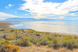
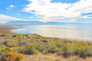
The Great Salt Lake is the largest saltwater lake in the Western Hemisphere and the most critical staging ground for migratory waterbirds in North America. Up to 10 million birds representing over 330 species rely on the lake and its surrounding wetlands annually. These include:
- 50% to 90% of the global population of Eared Grebes.
- Over one-third of the North American population of Wilson’s Phalaropes.
- Globally significant populations of American White Pelicans, Snowy Plovers, and Peregrine Falcons.
When the lake’s water levels drop precipitously, the exposed lakebed (playa) can generate toxic dust storms rich in heavy metals, while the shrinking surface area concentrates salinity to levels that collapse the brine shrimp and brine fly populations. Without these foundational macro-invertebrates, millions of migratory birds face starvation mid-migration.
Hydrological Pressures and Water Allocation
The Great Salt Lake is a terminal lake; it has no outlet. Water enters via three primary river systems—the Bear, Weber, and Jordan rivers—and leaves exclusively through evaporation. This hydrological reality makes the lake an ultimate barometer of upstream water use.
For decades, heavy agricultural diversions (which account for roughly 75% of water consumption in the basin), rapid municipal growth along the Wasatch Front, and industrial extractions have strained the system. Climate change has compounded these pressures through reduced snowpack retention, earlier spring runoffs, and higher ambient temperatures accelerating evaporation rates.
How the Assessment Addresses the Data Gap
Prior to the Audubon Assessment, land managers often lacked a unified, basin-wide prioritization framework. While individual state agencies tracked specific wildlife management areas (WMAs) and federal entities managed bird refuges, cross-boundary coordination was frequently hindered by differing mandates.
The Assessment solves this by providing a standardized, data-driven spatial hierarchy. It evaluates wetland condition, water permanence, vulnerability to drying, and avian use value across the entire basin. By quantifying these variables, the Assessment allows water managers to answer critical questions: If we have an extra 5,000 acre-feet of water to lease or purchase for environmental flows, where will it yield the highest ecological return on investment? Which wetlands are resilient enough to maintain function during drought, and which require immediate artificial augmentation or structural repair?
Official Statements and Institutional Perspectives
The true measure of the Assessment’s success is reflected in the enthusiastic reception it has received from across Utah’s institutional landscape. Rather than provoking defensiveness, the rigorous science presented by Audubon has catalyzed a spirit of collaborative problem-solving.
Bridging Science and State Policy
The involvement of the Great Salt Lake Commissioner and the Great Salt Lake Advisory Council highlights the policy-level gravity of the report. State leaders have repeatedly emphasized that saving the lake cannot be achieved through mandates alone; it requires precise data tools that enable voluntary, market-based, and cooperative water conservation.
"The challenge at the Great Salt Lake is fundamentally a balancing act between human necessity and ecological survival," notes regional water policy analysts. "Audubon’s Assessment provides the cartography for that balance. It tells us precisely where water is needed most urgently to prevent catastrophic habitat collapse."
Academic Validation: Utah State University Water Research Laboratory
Academic institutions have been quick to operationalize the report’s findings. Researchers at Utah State University’s Water Research Laboratory (USU WRL)—long renowned for cutting-edge hydrological modeling—have integrated the Assessment’s spatial data into their field campaigns.
According to USU researchers, the Assessment has helped identify optimal study sites for ongoing research examining the sources, transit times, and timing of freshwater flows entering the Great Salt Lake. By pairing Audubon’s avian habitat priorities with real-time streamflow and hydro-geological data, researchers can better model how upstream water management decisions directly ripple down to affect wetland salinities and invertebrate blooms.
Geological Insights: Utah Geological Survey
The Utah Geological Survey (UGS) has recognized the Assessment as a vital complement to its earth science programs. UGS officials have stated that the report’s detailed wetland mapping and ecological health indicators will directly inform and prioritize state-wide wetland scoring protocols. By tying geological strata and hydrological inputs directly to biological outcomes, the UGS can better forecast how landscape modifications and climate stressors will impact wetland resilience over coming decades.
Agricultural Alignment: A New Era of Collaboration
Perhaps the most notable cultural shift highlighted in the Water Report feature is the growing engagement of Utah’s agricultural community. Historically, agriculture and environmental conservation groups have frequently found themselves at loggerheads over water rights and allocations. However, the Audubon Assessment has opened new avenues for constructive dialogue.
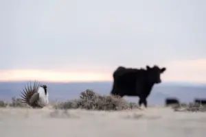
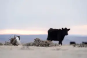
Representatives from the Utah Department of Agriculture and Food (UDAF) and the Utah Farm Bureau have expressed strong interest in utilizing the Assessment. Many farming operations in the basin—particularly in the Bear River Valley—overlap with or directly influence critical wetland ecosystems. Through tailwater management, rotational irrigation, and voluntary split-season leasing, agricultural producers are discovering that understanding the connections between farm practices, wetland health, and bird populations can lead to mutually beneficial outcomes. Healthy wetlands often act as natural filters and buffers, while sustainable farming communities are vital partners in keeping water in the basin rather than seeing agricultural lands subdivided into water-hungry municipal developments.
Future Outlook: Refining the Framework and Sustaining the Basin
As the ink dries on the initial implementation phase, Audubon and its diverse coalition of partners are already looking ahead. The release of the Assessment and its recognition in The Water Report are not viewed as a finish line, but rather as the foundational first step in a multi-decadal recovery effort for the Great Salt Lake Basin.
Next Steps in Habitat Prioritization
Audubon has committed to working hand-in-hand with state agencies, academic researchers, and agricultural stakeholders to continuously refine the habitat prioritization framework. As climate models evolve and new hydrological data flows in from USU and state monitoring stations, the Assessment’s underlying models will be updated to reflect shifting environmental baselines.
Key future priorities include:
- Dynamic Water Tracking: Enhancing real-time models that track how conserved water moves from upstream agricultural diversions down into specific terminal wetlands.
- Climate-Resilient Infrastructure: Identifying strategic locations for wetland restoration that can withstand prolonged drought and episodic extreme flooding events.
- Expanded Private Lands Stewardship: Scaling up incentives for private landowners and agriculturalists who manage working wetlands, ensuring they have the technical and financial support required to maintain habitat values.
A Beacon for Western Water Management
The transformation occurring around the Great Salt Lake offers a national—and international—template for terminal lake management. Across the American West, terminal lakes from Nevada’s Pyramid Lake to California’s Salton Sea face existential threats. Yet, the collaborative ecosystem developing around Utah’s inland sea demonstrates that rigorous science, when paired with inclusive stakeholder engagement, can overcome deeply entrenched political and economic divides.
By translating complex avian ecology and hydrology into practical, accessible, and operational insights, the Audubon Great Salt Lake Birds and Habitat Assessment has secured its place as a seminal document in Western water history. As state agencies, researchers, farmers, and conservationists continue to build upon its findings, there is renewed, scientifically grounded hope that the Great Salt Lake will remain a vibrant, life-sustaining anchor for generations of wildlife and human communities to come.